
Urban Heat Islands (UHIs) are areas within cities where temperatures rise significantly, primarily due to surfaces like concrete, asphalt, and limited green spaces. These urban areas trap heat, leading to discomfort, health risks, and environmental challenges. Understanding and mitigating UHIs requires accurate, localized, and real-time data. While satellite imagery has its uses, real-time LoRaWAN sensors on the ground are proving to be the smarter, more effective choice. Let’s explore why LoRaWAN sensors are transforming the way we manage Urban Heat Islands:
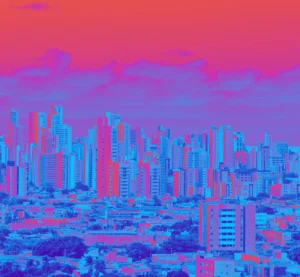
Thermal picture of a city
The Problem with Satellites
Blurred Details
Satellites capture broad views of the Earth’s surface, but they often struggle to zoom into the finer details of urban landscapes. A single pixel in a satellite image might represent an entire city block, blending diverse areas like shady parks, sunny plazas, and hot asphalt streets. This lack of granularity makes it challenging to pinpoint specific Urban Heat Island hotspots.
Not Real-Time
Satellite data is usually collected at specific intervals, such as every few days. This means that crucial information about daily temperature fluctuations, sudden heatwaves, or cooling after rainstorms is often missed. For cities seeking to monitor Urban Heat Islands dynamically and respond proactively, satellites fall short.
Surface vs. Air Temperature
Satellites measure surface temperatures based on heat radiating from rooftops, pavements, and other exposed surfaces. While this is useful for understanding heat retention in materials, it doesn’t capture the air temperature—the heat people actually experience, which directly impacts public health and comfort.
Weather Problems
Cloud cover can obstruct satellite views, creating gaps in data during cloudy or overcast days. Since Urban Heat Islands often need continuous monitoring, especially during extreme weather events, this limitation can leave cities without essential insights.
Expensive and Complicated
High-resolution satellite imagery can be costly to acquire, and processing the data requires expertise and advanced technology. For smaller municipalities or organizations, these costs and technical barriers make satellite data less accessible.
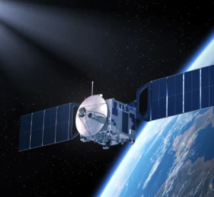
Satellite
Why are LoRaWAN Sensors better?
- Real-Time Data
LoRaWAN sensors provide continuous, up-to-the-minute temperature readings. This real-time data captures how UHIs evolve over the course of a day, from the morning’s gradual heat-up to peak afternoon temperatures and the cooling effect of nighttime. Such dynamic data is invaluable for effective urban heat management.
- Pinpoint Accuracy
Unlike satellites, LoRaWAN sensors can be deployed in specific locations to measure temperature variations with high granularity. Sensors can be installed in sunny plazas, shaded alleys, densely populated neighborhoods, and green spaces, providing hyper-local data that reveals the true diversity of urban heat conditions.
- Air Temperature Matters
LoRaWAN sensors measure air temperature directly, offering insights into the heat people experience every day. This data is crucial for urban planners and public health officials working to improve thermal comfort and reduce heat-related illnesses.
- Weather-Proof
LoRaWAN sensors work regardless of weather conditions, ensuring consistent and reliable data collection. This resilience is essential for uninterrupted monitoring and decision-making.
- Affordable and Scalable
LoRaWAN sensors are cost-effective, energy-efficient, and easy to deploy. Cities with existing IoT infrastructure can integrate these sensors seamlessly, scaling their networks to cover as much or as little of the city as needed. This makes them a practical choice for municipalities of aall sizes.

LoRaWAN sensor
A Winning Combination
Satellites aren’t entirely obsolete in UHI detection. In fact, they’re excellent for providing a macro-level overview of large-scale UHI trends. However, their strengths lie in broad mapping, not detailed, actionable data. Pairing satellite imagery with LoRaWAN sensor networks offers the best of both worlds: satellites deliver the big picture, while sensors provide real-time, street-level insights.
For example, satellite data can identify potential UHI hotspots across a city, and LoRaWAN sensors can then monitor these areas in real-time to track changes and assess the effectiveness of interventions like tree planting or reflective pavements.
The way we monitor and manage Urban Heat Islands is evolving, and LoRaWAN sensors are leading the charge. These sensors provide precise, real-time, and actionable data that can help cities stay cool, livable, and sustainable. While satellite imagery remains useful for initial mapping and large-scale assessments, the future of UHI detection lies in combining it with smart, ground-level networks.
By integrating LoRaWAN sensors into smart city frameworks, we can create urban environments that are not only smarter but also cooler—literally and figuratively.