_______
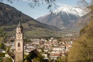
Climate change is no longer a distant projection on television, but a daily reality cities face worldwide. Nestled in the heart of South Tyrol, two neighboring alpine cities, Merano and Bolzano, are confronting severe urban heat islands, worsening air pollution and extreme weather fluctuations, despite being surrounded by mountains and greenery.
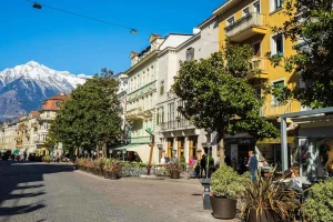
In the alpine basin, the urban heat island phenomenon is even more pronounced due to the exceptionally clean mountain air, which makes solar rays much stronger and more piercing, as well as the historic architecture where older buildings store heat and radiate it back out at night. General regional weather forecasts are insufficient, as experts have recorded microclimatic temperature differences of up to 8 degrees Celsius on the exact same street, depending on building materials and density. The broader vision of these municipalities relies on sustainability, data-driven decision-making and the integration of nature-based solutions to secure a safe, smart and long-term resilient urban environment.
Challenges
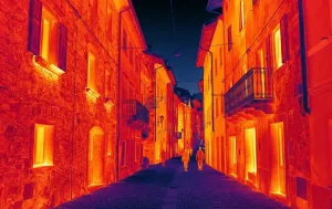
Severe Urban Heat Islands – High thermal mass from historic stone architecture and dense asphalt surfaces trap solar energy during the day and radiate it back aggressively at night.
Severe Microclimatic Discrepancies – General regional forecasts fail to capture localized temperature spikes, missing up to 8°C variations across the exact same street.
Public Health & Infrastructure Stress – Extreme temperature fluctuations degrade urban well-being, increase peak energy consumption and strain city infrastructure.
Lack of Granular Visibility – Traditional weather models rely on distant stations, leaving municipal planners without the real-time, ground-truth data required for precise nature-based interventions.
Real-time conditions lead to decisions
City managers and municipal utilities face critical operational pain points that demand immediate intervention:
Heat and Extreme Temperature Management: Concrete, asphalt surfaces and dense buildings absorb solar radiation during the day and release it slowly at night, creating urban heat islands where temperatures are significantly higher than in the surrounding countryside.
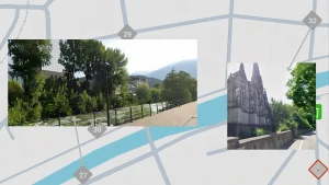
Microclimatic temperature variance measuret at the exact same moment in Merano, illustrating how proximity to flowing water and dense green infrastructure cools the environment to 27°C (left), while the thermal mass of historic stone architecture and asphalt traps and radiates heat, elevating local temperatures to 32°C (right).
Negative Impacts on Public Health and Infrastructure: Heatwaves affect population well-being, health, energy consumption and urban infrastructure.
Lack of Granular Data: Due to uneven zones (such as direct sunlight versus shaded parks or the cooling impact of vegetation), general measurements fail to reflect real ground conditions, making precise planning difficult.
How it works
By shifting away from generic regional weather forecasts and deploying an advanced microclimate monitoring network, city planners and municipal utilities can finally address the blind spots caused by extreme urban heat islands. Instead of guessing where thermal stress peaks, decision-makers gain actionable, granular intelligence:
Eliminating Data Blind Spots: By strategically placing over 30 Senstick Microclimate SMC30-OUT sensors across contrasting zones such as scorching asphalt, shaded parks and tree canopies the system provides precise, real-time visibility into microclimatic variations like the 8°C differences found on a single street.
Non-Disruptive Scalability: Leveraging the LoRaWAN network enables the system to scale across distances of up to 15 km without requiring costly civil works, road excavation or any disruption to sensitive historic city infrastructure.
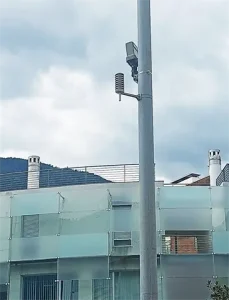
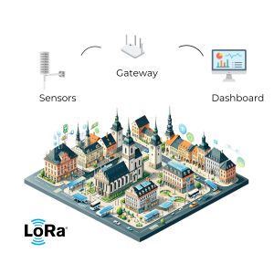
Seamless Centralized Control: Raw environmental data flows automatically through open-source ChirpStack network servers directly into the municipal utility’s (Stadtwerke Meran) central hub. By making this data accessible via MQTT/APIs and public dashboards, city managers are equipped to implement data-driven, nature-based solutions precisely where heat stress threatens public health and urban infrastructure.
Solution
The deployment establishes a high-resolution, continuous environmental monitoring architecture designed specifically for complex alpine urban topographies.
- Exposed asphalt plazas, dense historic street canyons, shaded public parks and urban tree canopies across Merano and Bolzano.
- Real-time microclimatic air temperature, relative humidity and thermal radiation variances.
- Over 30 Senstick Microclimate SMC30-OUT sensors transmitting via a robust, LoRaWAN infrastructure over distances up to 15 km without civil excavation.
- Environmental data streams seamlessly through ChirpStack network servers into centralized management dashboards (including integration via MQTT/APIs), empowering municipal authorities to shift from reactive estimates to proactive, data-driven urban cooling strategies.
How to correctly deploy
Deploying environmental monitors successfully across a historic city requires precise spatial methodology and adherence to technical constraints:
Contrasting Zone Selection: Measurement points are strategically placed in temperature-critical zones ranging from exposed asphalt and dense urban developments to shaded parks, tree canopies and riverbanks.
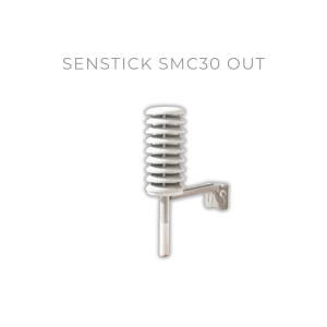
Orientation and Mounting Rules: For optimal signal strength and thermal accuracy, sensors like the SMC30-OUT must be mounted securely with the antenna part (white cap) facing upwards, utilizing specialized hardware kits to ensure stability in harsh weather conditions without damaging historic facades.
Why LoRaWAN is perfect
Leveraging the LoRaWAN network enables the system to scale across distances of up to 15 km without requiring costly civil works, road excavation or any disruption to sensitive historic city infrastructure.
Operating efficiently on low-power radio frequencies, the network allows individual nodes to transmit high-frequency telemetry reliably through dense urban canyons while running on internal batteries for years.
Reliability built on decades of IoT experience
The introduction of the smart system delivers measurable financial and operational value for the city and its operators:
Transition from Reactive to Proactive Decision-Making: Instead of reacting to problems after they occur, the municipal administration gains objective, continuously updated data that reduces the influence of biases and personal emotions in urban planning. Planners can anticipate heatwave bottlenecks and allocate emergency cooling interventions before public health advisories are triggered.
Resource and Measure Optimization: Data directly demonstrates that trees and vegetation decrease air temperature, allowing the city to target greening projects, shading concepts, cooling surfaces and optimize winter de-icing salt usage more effectively. Municipal crews no longer waste resources applying treatments uniformly; instead, deployments are precisely aligned with localized frost or heat data.
Enhanced Sustainability, Transparency and Community Trust: The entire solution relies on open-source technology without licensing fees, while public data accessibility fosters transparency, citizen trust and the long-term development of a smart and resilient city. Initiatives backed by transparent telemetry encourage local universities, researchers and engaged citizens to co-create urban resilience strategies.
Benefits
Replaces guesswork with continuous telemetry, allowing city planners to anticipate heatwave bottlenecks and target green infrastructure where it matters most.
Provides precise, localized data to optimize urban cooling interventions, public health advisories and winter maintenance planning (such as de-icing salt allocation).
Supplies objective metrics that validate the cooling impact of trees, vegetation and flowing water, removing personal bias from municipal policies.
Operates entirely on open-source technology without recurring licensing fees, making real-time environmental data accessible to citizens, local universities and researchers to co-create sustainable resilience strategies.
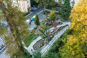
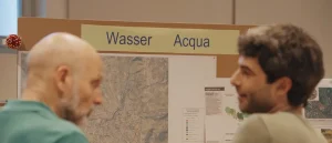
The Garden for All: Through interactive workshops using visual tools and LEGO bricks (which helped bridge the communication gap between German and Italian-speaking residents), locals co-created a public edible garden.